
Lestes tenuatus Rambur, 1862
|
publication ID |
https://doi.org/10.11646/zootaxa.5415.2.1 |
|
publication LSID |
lsid:zoobank.org:pub:859C14F9-FC21-4076-A212-3B4B6E35E8B7 |
|
DOI |
https://doi.org/10.5281/zenodo.10692944 |
|
persistent identifier |
https://treatment.plazi.org/id/03D88059-FF62-FFB8-8FA1-7AE8670256EB |
|
treatment provided by |
Plazi |
|
scientific name |
Lestes tenuatus Rambur, 1862 |
| status |
|
Lestes tenuatus Rambur, 1862 View in CoL
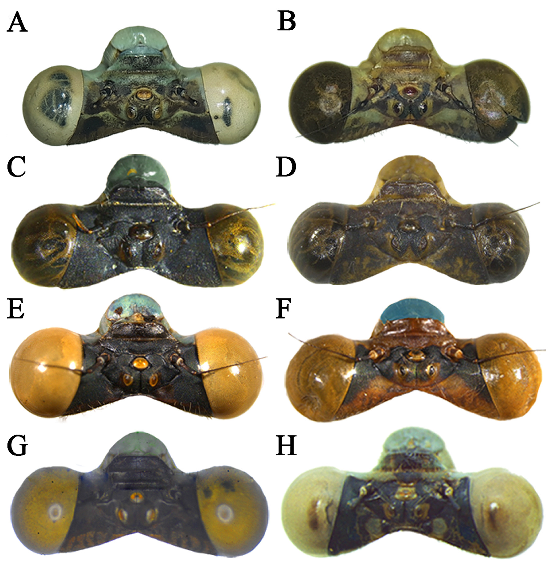
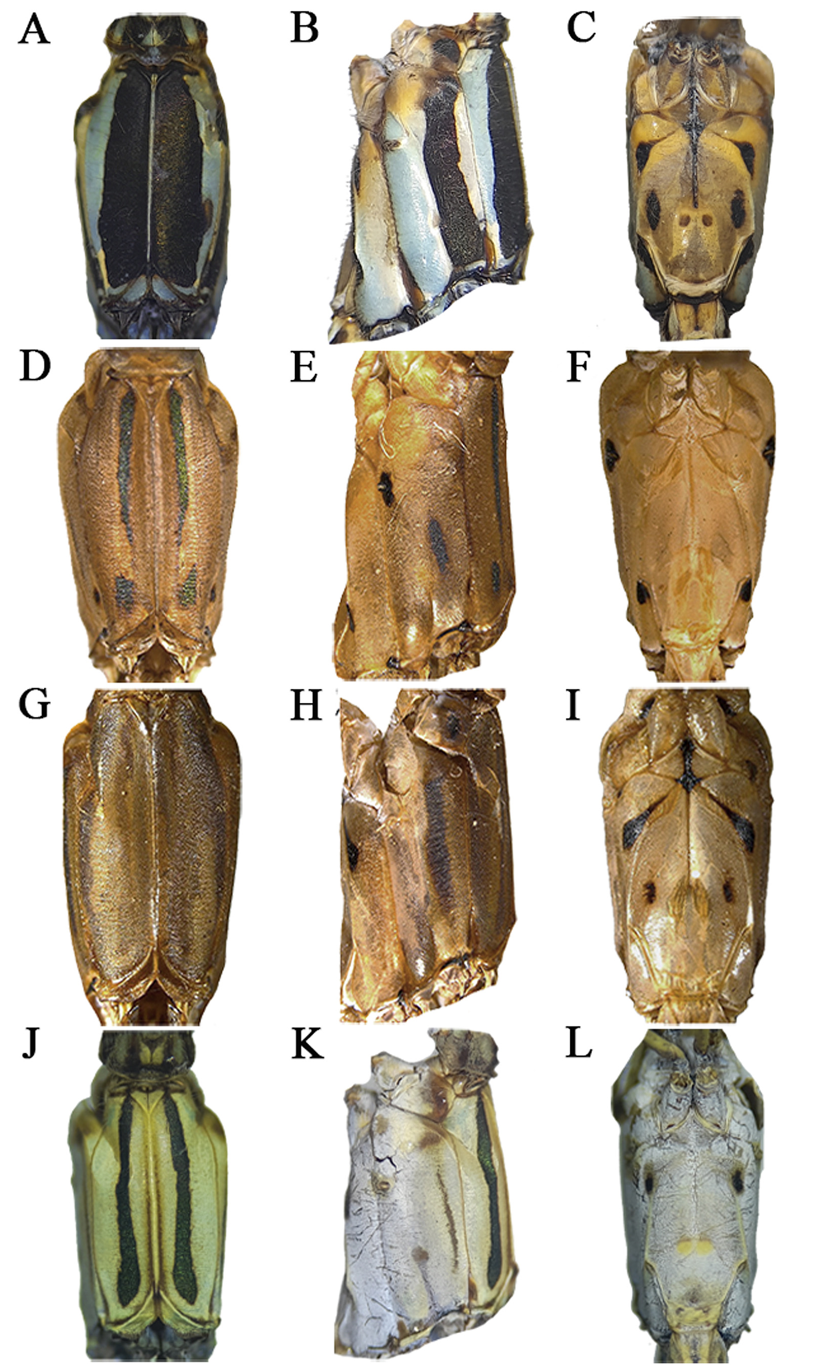
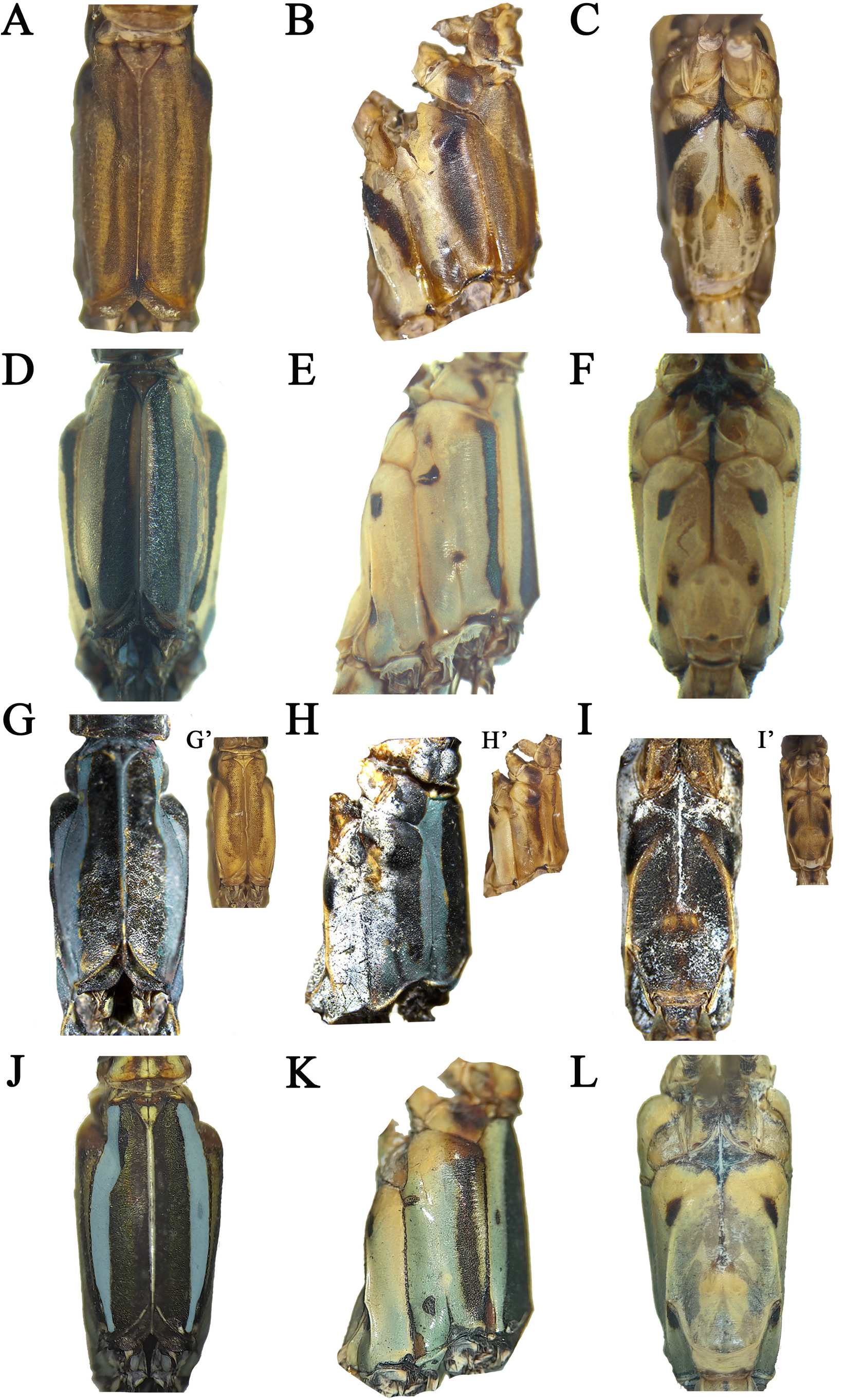
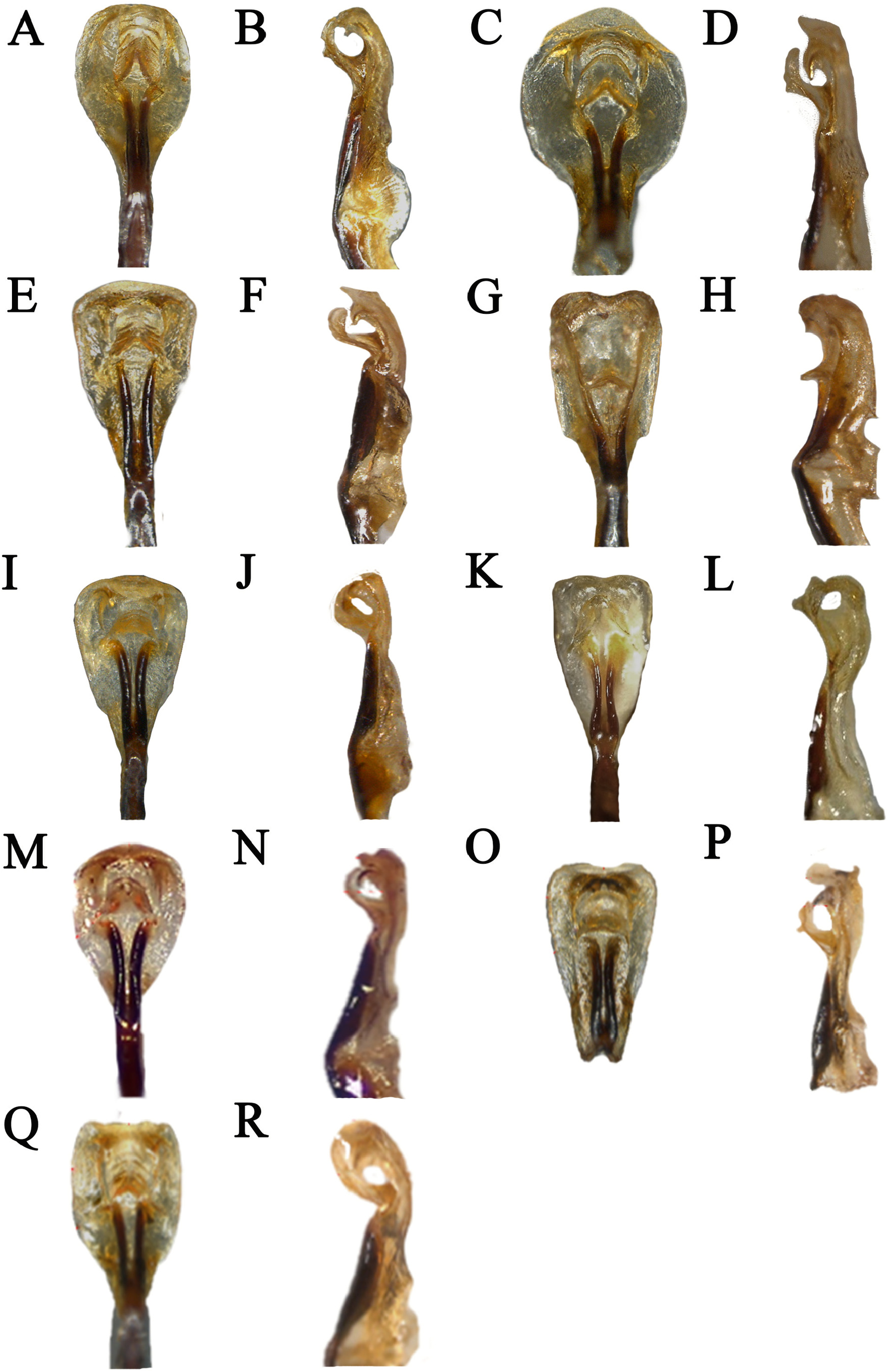
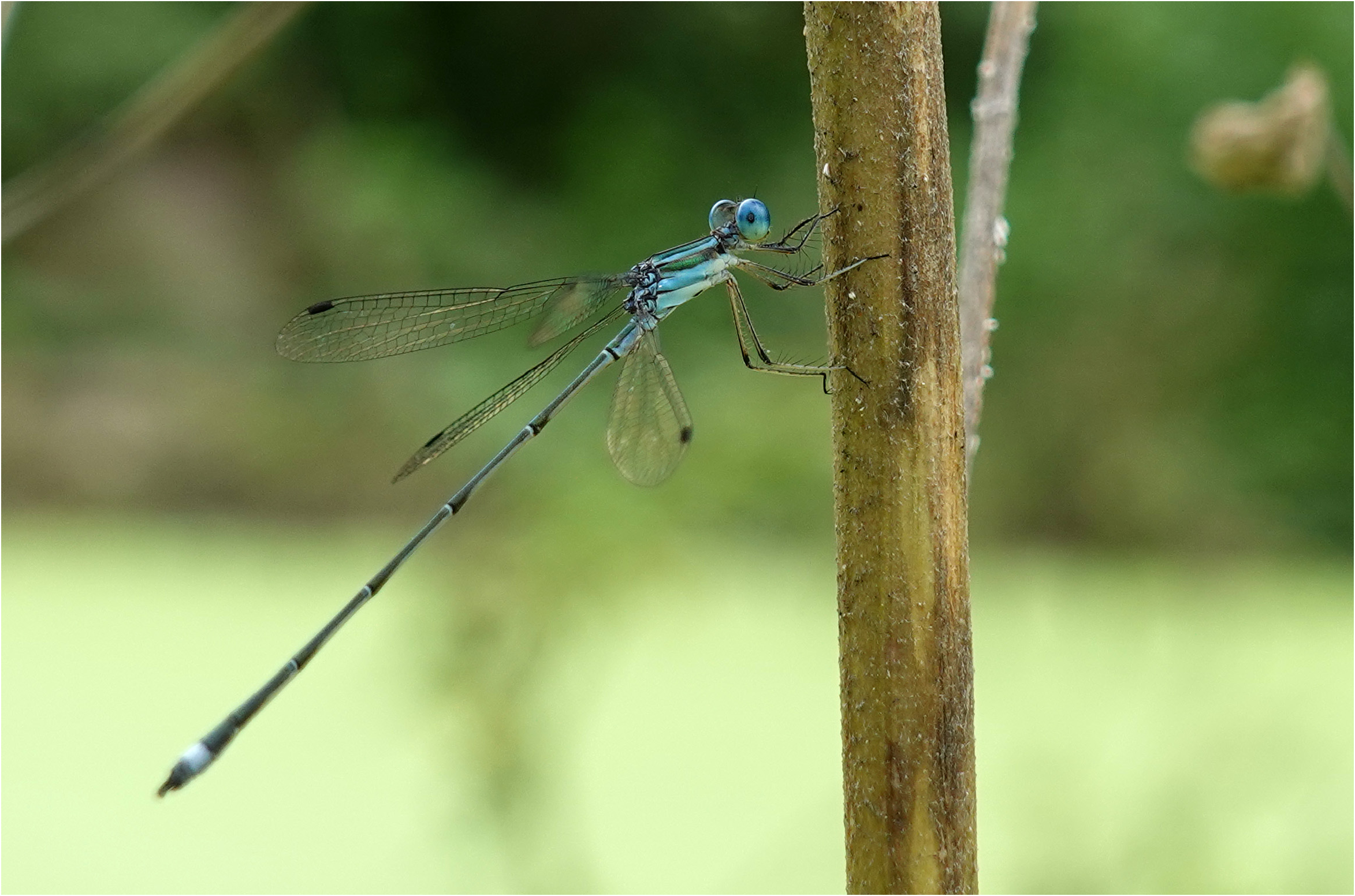
Fig. 5E–F View FIGURE 5 (♁ and ♀ head), Fig. 8J–L View FIGURE 8 (♁ pterothorax), Fig. 9Q–R View FIGURE 9 (♁ genital ligula), Fig.11O–P View FIGURE 11 (♁ caudal appendages), Fig. 13J–L View FIGURE 13 ( ♀ pterothorax), Fig. 14H View FIGURE 14 ( ♀ caudal appendages), Fig. 17 View FIGURE 17 (distribution), Fig. 26 View FIGURE 26 (♁ field photo).
Etymology: tçnűâtus latin for faint.
Type locality: Martinica .
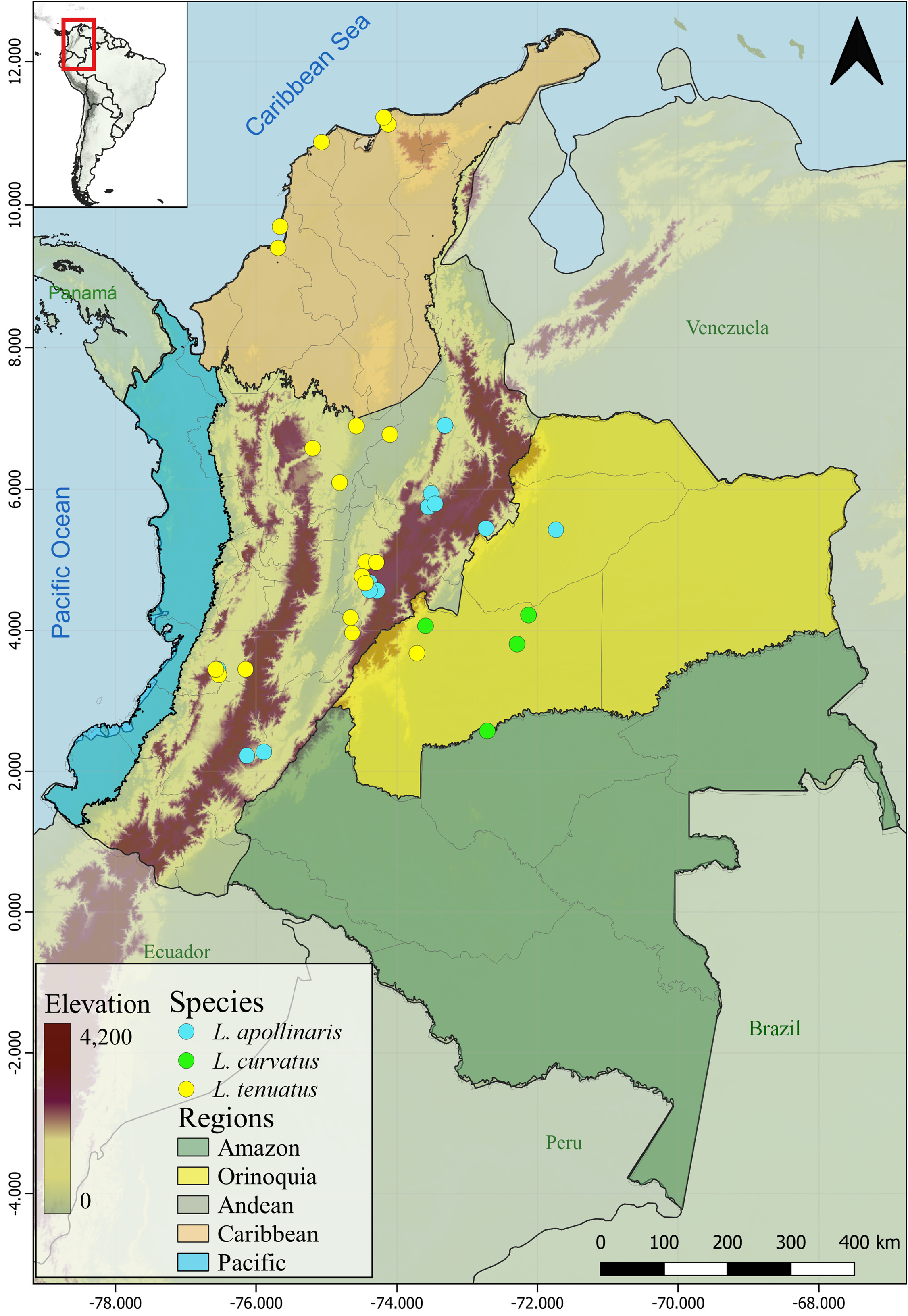
Distribution: Belize; Colombia ( Atlántico, Cundinamarca, Magdalena, Meta, Sucre, Tolima, Valle del Cauca), Costa Rica, Cuba, República Dominicana, El Salvador, Guatemala, Honduras, Jamaica, México, Panamá, Venezuela.
Female described: Yes Larva described: Yes— Calvert (1928), Geijskes (1941)
Altitudinal range: 0–1000 m IUCN status: LC— Paulson (2017)
Records in previous references: Calvert (1909), Pérez-Gutiérrez & Palacino-Rodríguez (2011)
Material examined: (31♁♁, 6♀♀). Colombia, Atlántico, Juan de Acosta , 10.8529N, 75.0567W, 240 m, 23-10- 2001, L. Pérez, K. Reatamoza, M. Pozo, J. Aguilar, O. Mejia leg., 3♁♁ ( UARC 1035 , 1036 , 1038 ) GoogleMaps ; Chocó , Nuquí, Termales, 5.6060N, 77.4411W, 7 m, 07-2023, J. Montes, leg., 1♁ ( UARC 1328 ) GoogleMaps ; Guajira, Albánia, 11.1021N, 72.6834W, 221 m, 1-11-2021, J. Montes, leg., 1♁ ( UARC 1402 ) GoogleMaps ; Magdalena , Santa Marta , 11.2875N, 73.9938W, 50 m, 21-10-2001, L. Pérez leg., 2♁♁ ( UARC 1039 , 1074 , 1075 ) GoogleMaps ; Antioquia , Gómez Plata, 6.5810N, 75.1950W, 1000 m, 09-07-2003, C. Bota leg., 2♁♁ ( CEUA 40225 , 40244 ) GoogleMaps ; Remedios , finca la Brillantina, 6.8833N, 74.5666W, 500 m, 28-08-2011, C. Moreno, C. Bota leg., 3♁♁ ( CEUA 81485 , 81486 , 81487 ) GoogleMaps ; San Luis , El Prodigio, 6.0930N, 74.8144W, 500 m, 03-03-2012, 1♁ ( CEUA 71128 ) GoogleMaps ; Santander , Puerto Parra, Bocas del Carare, 6.7730N, 74.0994W, 96 m, 07-09-2013, 1♁ ( CEUA 81392 ) GoogleMaps ; Sucre , San Onofre, Berrugas, 9.7101N, 75.6666W, 0 m, 27-05-2009, C. Bota leg., 1♁ ( CEUA 45509 ) GoogleMaps ; Cundinamarca , Anolaima, 4.7618N, 74.4637W, 1657 m, 16-11-2016, E. Realpe leg., 1♁ ( ANDES-E 22415 ) GoogleMaps ; La Mesa , vereda la Doima, 4.6705N, 74.4433W, 1150 m, 01-04-2004, E. Realpe leg., 1♁ ( ANDES-E 3819 ) GoogleMaps ; Magdalena , Santa Marta , 11.1315N, 74.1225W, 680 m, 09-09-2001, L. Pérez leg., 2♁♁ ( ANDES-E 16172 , 17311 ) GoogleMaps ; as the previous but, 11.2875N, 73.9939W, 50 m, 21-10-2001, L. Pérez leg., 2♁♁ ( ANDES-E 16925 , 16926 ) GoogleMaps ; Sucre , Tolú, 9.4032N, 75.6780W, 0 m, 10-07-2013, L. Pérez leg., 2♁♁ ( ANDES-E 22411 , 22412 ) GoogleMaps ; Tolima , Cunday, vereda El Edén, 3.9661N, 74.6331W, 1139 m, 1♁ ( PUJ) GoogleMaps ; Cundinamarca , Sasaima, 4.9741N, 74.4371W, 1071 m, 1♀ ( ICN) GoogleMaps ; Meta , San Martin, km 30 vía Villavicencio, 3.6761N, 73.7111W, 415 m, 1♁ ( ICN) GoogleMaps ; Tolima , Melgar, 4.1831N, 74.6571W, 331 m, 1♁ ( ICN) GoogleMaps ; Valle del Cauca , Cali, Univalle, 3.3731N, 76.5311W, 982 m, 2♁♁, 4♀♀ ( MUSENUV) GoogleMaps ; Pradera , La Buitrera, 3.4501N, 76.1491W, 1994 m, 1♁ ( MUSENUV) GoogleMaps ; Cali , Jardín botánico Juan María Céspedes, 3.4491N, 76.5721W, 1100 m, 2♁♁, 1♀ ( MUSENUV) GoogleMaps .
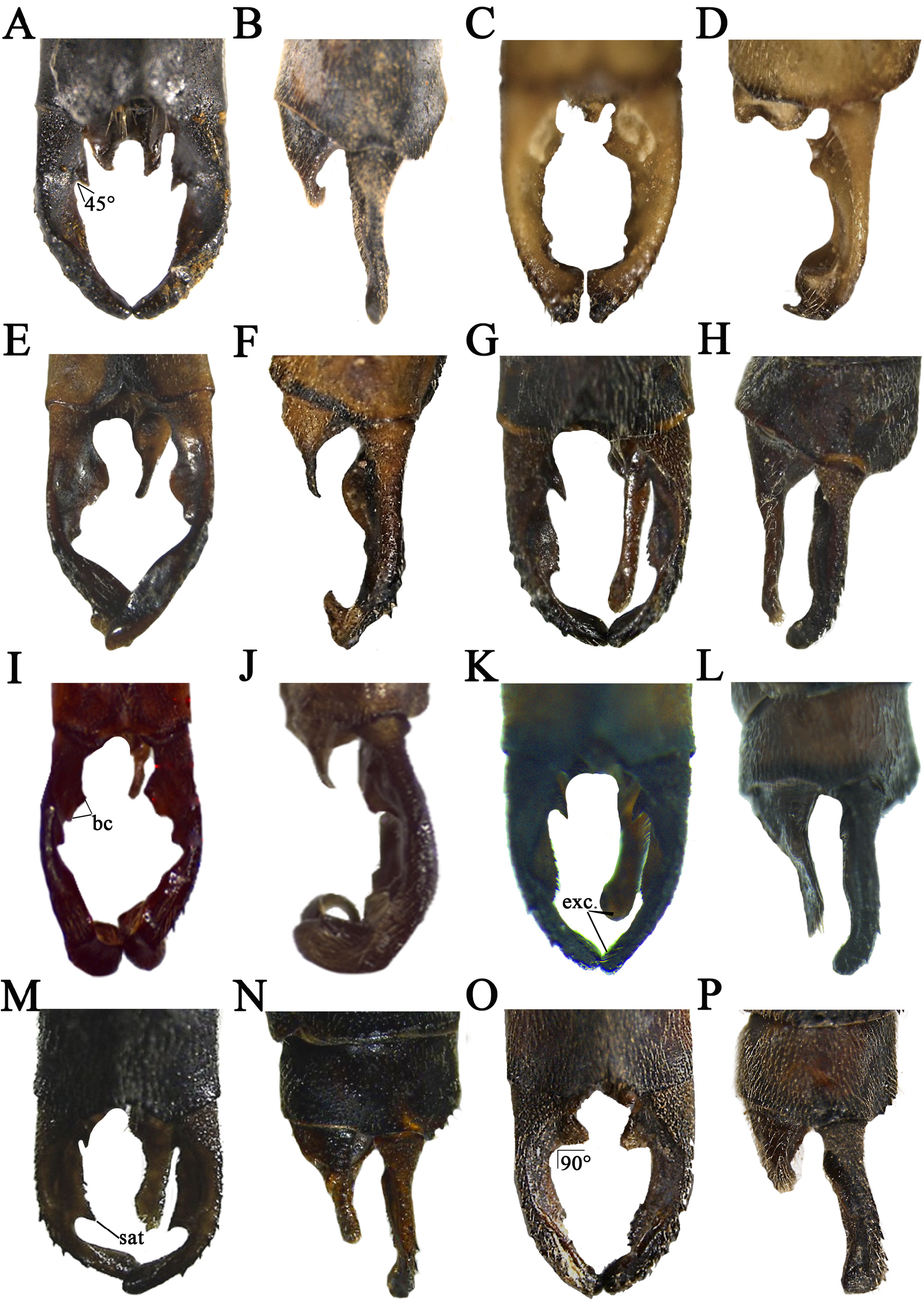
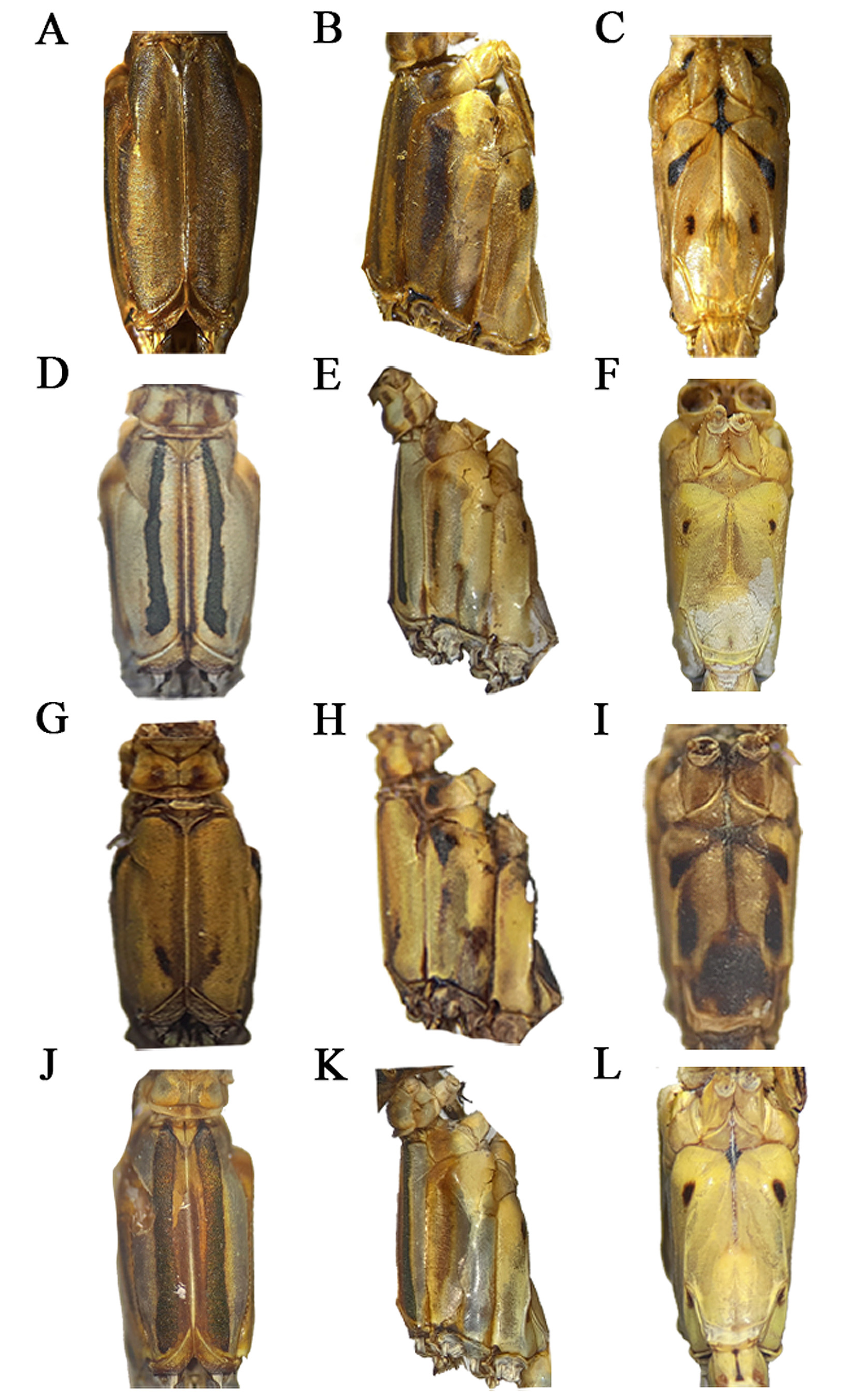
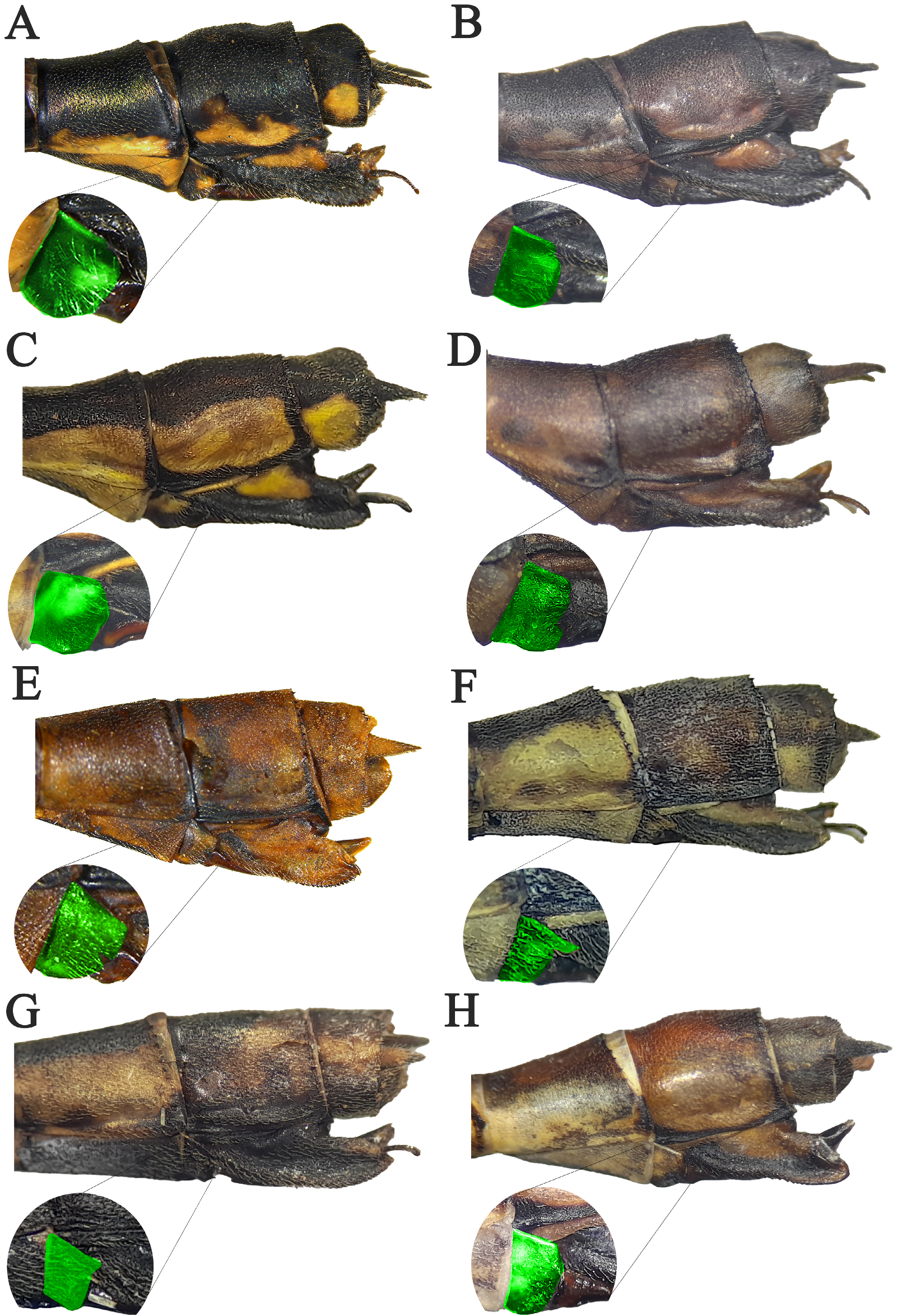
Morphological characteristics: male head epicranium dark brown, labrum, clypeus, and mandibles pale blue ( Fig. 5E View FIGURE 5 ). Male pterothorax coloration pattern blue and yellow, with two longitudinal green bands on the mesepisternum and blue antehumeral stripe ( Fig. 8J View FIGURE 8 ); mesepimeron mostly brown; metepisternum and metepimeron mostly blue ( Fig. 8K View FIGURE 8 ); posternum ( PST) (pectum) with a couple of black dots adjacent to the latroventral carina, and with a black apex on metapostepimeron ( PEM 3) ( Fig. 7L View FIGURE 7 ). Genital ligula with rectangular shape ( Fig. 9Q View FIGURE 9 ), the inner fold is well-developed and exceeds the anterior terminal fold of S2 ( Fig. 9R View FIGURE 9 ). Male cerci long with an acute tooth in a basal region projected distally at a 90° angle; edge of medial portion straight with a row of denticles; primary curvature type II ( Fig. 11O View FIGURE 11 ); secondary curvature type I ( Fig. 11P View FIGURE 11 ). Paraprocts developed, apophyses almost 1/3 of length cerci, curved apices ( Fig. 11P View FIGURE 11 ). Female head with a transversal black band, posterior margin blue ( Fig. 5F View FIGURE 5 ). Female pterothorax coloration pattern as male ( Fig. 13J–L View FIGURE 13 ). Basal plate with posterior (P) and ventral ( V) sides divided in two ( Fig. 14H View FIGURE 14 ).
Remarks: This species is distributed from the United States, through Central America (including Antilles) to Colombia and Venezuela. Due to its wide distribution area, it is categorized as LC (Least Concern) according to the IUCN ( Paulson 2017). Here, we report the occurrence of this species in the departments of Cundinamarca, Sucre, and Tolima.
No known copyright restrictions apply. See Agosti, D., Egloff, W., 2009. Taxonomic information exchange and copyright: the Plazi approach. BMC Research Notes 2009, 2:53 for further explanation.